Saturday, December 26, 2015

Christmas Weather: Past and Present


You may not think twice about it, but while celebrating the holiday season, weather plays an important role. 

You may find yourself asking several weather-related questions, such as:
  • What will the roads be like?
  • Will our flight be on time?
  • Do we need to dress warm?
  • What kind of jacket do I need?
  • What kind of clothes should I pack?

Whether you're heading down the road or across the country, national weather patterns can drastically impact the holiday season and success can be measured by how much our original plans had to change. 

Flexibility is key. 


Thankfully, this Christmas was uninhibited by 'bad' weather in the Toledo area. Northwest Ohio residents were treated to above average temperatures, dry conditions and some sunshine on what is notorious for being the coldest holiday of the year.

Thanks, El Nino.


Wednesday, December 23, 2015

Wind Damage Wednesday Evening, December 23rd

Wind damage has been reported shortly after 6:00 PM at several locations in our viewing area.  This damage is at the northern end of a severe weather outbreak that includes numerous tornadoes in Illinois, Tennessee and Mississippi.  As of 8:00 PM Wednesday two people are reported killed in Ashland, MS.


6:10 PM:  A barn was reported collapsed on township road 118 in northwest Hancock county.


Several wind reports came in from near the state line up into parts of Lenawee county.


6:08 PM:  A barn destroyed with debris scattered up to 50 yards.


-First Alert Chief Meteorologist Robert Shiels

Monday, December 21, 2015

Delivering Record Christmas Week Warmth

Who exactly was it that asked Santa for record breaking Christmas week warmth?  Long gone have been the hopes for a white Christmas.  Onward to record highs on Wednesday of this week with temperatures reaching into the low 60s!  That's an astounding 25 to 30 degrees above average.  In fact, each day through Christmas day will be well above average.

The Set Up: Record Warmth Christmas Week

I'm nearly certain this December will be the warmest in over 100 years...and could very well rival one of the warmest December's on record.  

Warmest December's:  

2015** -- 41.2°
1889 -- 41.1°
1887 -- 40.3°
1881 -- 39.4°
1923 -- 38.8°
1931 -- 38.1°

**Thru the first 20 days

December Summary To Date
In addition, this December is very likely to end with no measurable snowfall for only the 4th time in Toledo's recorded history!

~Meteorologist Chris Vickers

Friday, December 11, 2015

Record Weekend Warmth

How about this December warmth? New record highs are ahead! Here are the current standing records for this weekend:

Saturday -- December 12th -- 63° (1949) -- Forecast: 64°
Sunday -- December 13th -- 62° (1975) -- Forecast: 66°

High Temperatures: Well Above Average

High temperatures will be a solid 20 to 30 degrees above normal through the weekend.  Although it will be cloudy with areas of fog and drizzle much of Saturday.  Sunday will also be cloudy, but mainly dry for most areas.  Despite the clouds, bring on the warmer weather. A parade of strong Pacific Coast storms will drive a wave of energy into the southern Plains of the United States.  This well drive a developing low pressure system and a surge of unseasonably warm air into the lower Great Lakes.

Surge of Warmer Air
Highs this weekend will reach record highs. Only 8 times in Toledo's history has a high temperature reached above 65°.  This weekend will likely add one, and possibly another day to that count.

December 29, 1889 -- 70°
December 5, 2001 -- 70° 
December 6, 1998 -- 69°
December 2, 1982 -- 68°
December 3, 1982 -- 68°
December 10, 1971 -- 67°
December 31, 1875 -- 66°
December 5th, 1998 -- 66°


December looks to turn cooler late next week.  No doubt, the buzz will turn toward the chance of a white Christmas.  Historically, the chance for northern Ohio is around 30-40%.  An early look at this year will bring a lower than average chance at a white Christmas, likely less than 20%.

Historical Probability of a White Christmas

Tuesday, December 8, 2015

Big Weekend Warm-up

Record highs are in jeopardy this weekend thanks to an unusually warm pocket of December air heading our way. 


We are currently forecasting highs in the low/mid 60's. This would mark Toledo's first return to the 60's in December since early December 2013. 

Records for this weekend are: 

Saturday --- 63
Sunday --- 62


With the warm air also comes a return of tropical moisture. This will likely produce very heavy rainfall by December standards. Rain totals over 1" between Sunday and Monday appear very likely.


Stay tuned to WTOL and Fox 36 for the latest information on the weekend warm-up and potential heavy rainfall.

Be sure to download the WTOL First Alert Weather App too! It's a free download. You can easily access an exclusive 10-day forecast from our weather team on it.


Wednesday, December 2, 2015

Winter Weather Outlook

Winter is officially on the clock with the start of Meteorological Winter on December 1st.  I've called your bluff Old Man Winter and time will prove this true. A colossal El Niño will dominate.   El Niño, which is classified by the warming of the equitorial Pacific waters off the coast of South America can and does alter global atmospheric circulation.  Typically, this ties the polar jet stream up north into Canada which can significantly limit the frequency and intensity of cold air outbreaks. The impacts of such an occurrence have driven our winter weather pattern in the past and will very likely dictate our winter weather this year too. 

Here is a look at historical El Niño winters.  Since 1950, there have been five "Strong" or "Very Strong" El Niño years:

El Niño Winters:

1997-1998
1982-1983
1972-1973
1965-1966
1957-1958

El Niño Winter Temperatures
 Every winter with a strong or very strong El Niño resulted in a warmer than average winter.  The strongest El Niño on record during 1997-1998 brought an exceptionally warm winter that averaged nearly 7 degrees above normal!  Do you remember this winter?  I do! Winter snow rarely, if ever covered the ground and spring flowers bloomed in January.  (I recall playing golf TWICE in January!)
El Niño Winter Snow
 Snowfall during the 1997-1998 El Niño resulted in less than 4" of snow for the entire winter!
After two historic and brutal winters the past two years that brought all time record snow -- 86" of snow in the winter of 2013-2014 -- and frigid record shattering cold --3rd all time coldest calendar month on record in February of 2015 -- winter this year will bring a welcome change.  The winter outlook for our area will be warmer than normal with below average snowfall.

Winter Temperature Outlook
 +2 to 4° Above Average 

Winter Outlook Temperatures

Winter Snowfall Outlook
15 to 20" Below Average (About 50% of Normal Snowfall)

Winter Outlook Precipitation
This blossoming very strong El Niño will drive very mild weather this weekend and through next week. Much, if not most to the United States will be well above average through the middle of December. 
GFS Temperature Anomaly valid Thursday, December 10th
While any winter will feature some snow and cold, that is inevitable. Occasional cold snaps or even the possible snow storms are part of any winter.  These can and still will happen.  There are several factors beyond El Nino that can influence winter weather.  But, overall, get used to the more regular mild winter weather that lies ahead this season.


~Meteorologist Chris Vickers

Monday, November 23, 2015

THANKSGIVING DAY


Thanksgiving Day will be warm and dry.
The sky will cloud over with highs in the 50s.
You can expect south-southwest winds increasing to 10-20mph.

Friday, November 20, 2015

SATURDAY - ALERT DAY FOR WINTRY WEATHER


By late Saturday night snowfall amounts may reach 1-3" on a line from Defiance through the Toledo Metro Area and points north.  This will start out as a wet rain/snow mix by early afternoon, changing to all snow past sunset.  The biggest travel concern will be bridges and overpasses Saturday night as temperatures drop below freezing.


At the onset of precipitation surface temperatures will be above freezing.  You can expect most if not all of the snow to melt on impact in the late morning/early afternoon.


Precipitation is most likely to pick up in the Toledo Area in the early afternoon.


Rain/snow mix will change to all snow in the Toledo Area near sunset.
This means the most likely time for accumulating snow is between 6:00 PM and 10:00 PM.


Travel conditions will be tougher across lower Michigan.  Any travel north of I-94 can expect to see heavier snow accumulations Saturday afternoon/evening.

Robert Shiels WTOL

ALERT: Snow Saturday

WHAT WE'RE TRACKING


Forecasting accumulating snowfall is one of the biggest challenges a meteorologist faces, but the First Alert Weather Team is up for it! Because several of our computer models disagree, it's our job to analyse and interpret at a deeper level. 


Snowfall looming in the forecast Saturday brings:

  •  Our 1st accumulation of the season
  •  Low visibility
  •  Slick roadways

As of 12:00pm Friday, here is the most up to date forecast using the data available to us:

This band of wintry weather is all about location, location, location. A Winter Storm Watch is in effect for Hillsdale, Lenawee and Monroe counties in Michigan. These three counties are expected to be hit with the largest accumulations in our entire viewing area. 


The Winter Storm Watch is in effect late Friday evening until 9pm Saturday. Potential for significant accumulations leads to difficult travel conditions. 


WINTER WEATHER TIMELINE 


FRIDAY EVENING: Increasing cloud cover, chilly, dry. We'll experience a strong wind chill factor during Big Board Football games and an incredibly cold setting before snow showers arrive. 

SATURDAY MORNING: A few flurries to begin the day. Temperatures rising above the freezing point into the early afternoon. Cloudy skies, few passing showers. 


Rain with snow mixing in will turn primarily to wet, slushy snowfall by dinnertime. 


From 4-7pm, the greatest accumulation of snow will occur across the area. 


Accumulation amounts range from <1" to +4" depending on location. Greatest accumulations will occur north and west of Toledo, mainly in parts of SE Michigan.

Preparation, as with any band of inclement weather, is key. Download our First Alert Weather App and tune in to WTOL 11 all weekend long for updates. 


Thursday, November 19, 2015

A TASTE OF WINTRY WEATHER ON SATURDAY


6:00 AM:  Low pressure area moving into Illinois.
A heavy, wet snow is likely in Chicago first thing Saturday morning. 


Noon:  A chance of rain/snow will spread into our viewing area by midday.
Temperatures will be above freezing at this time.
Any snow that falls will melt on impact through the afternoon.


Mid-Michigan:  an accumulating, slushy snow is most likely in places like
Kalamazoo, Grand Rapids, Lansing and Flint.


6:00 PM:  After sunset minor accumulations of snow will be possible in
northwest Ohio and southeast Michigan.
The risk of slippery road surfaces will increase into Saturday night.

Be sure to check back for updates.
This forecast issued at 5:00 PM Thursday.

Robert Shiels WTOL

Tuesday, November 17, 2015

Gusty Winds Wednesday


Morning:
You can expect some sunshine with southerly winds 10-20mph.
Temperatures will climb quickly into the mid 60s by the lunch hour.


Early afternoon:
A line of showers will move through from west to east.
Winds along this line will gust to over 35mph.
The line of showers is most likely to arrive in Toledo between 1PM-4PM.


Highs in the upper 60s Wednesday will come right around 1:00 PM.

-Robert Shiels WTOL


Monday, November 16, 2015

SNOW IN NOVEMBER?

SNOW IN NOVEMBER?

It has been so mild lately it has many wondering "will there be any snow this month?"
The fact is it is common to get through November with no measurable snow.


The normal snowfall amount for November is about 2".
In the last five years we have had only a trace of snow twice, 2012 and 2010.

The record for the month is 18" set in 1966.
The winter of 1966-67 is currently 5th on the list for most snow with 61".

Submitted by:  Robert Shiels WTOL

Sunday, November 15, 2015

You Won't Believe This: 2014-2015 Seasonal Difference

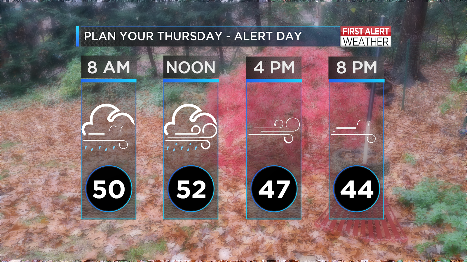
It should go without saying; the late fall/early winter season of 2015 has been easy on us NW Ohioans. Sure, some rain. Strong winds, yeah. But snow? Ice? Bitter cold? Nope, nope, nope. 

Hanging on to False Hope

Let's take a walk down memory lane. November 2014 started off cooler than average, but bounced back enough to trick us into preserving hope that all was not lost. 

The first week and half went smoothly with highs in the 40s and 50s and lows near the freezing point a handful of times. Nothing out of the ordinary for such a transitional month as November. Before experiencing a change that would define our entire winter season, we hit the warmest high of the month on November 11th. A high of 64° was certainly a treat, but nothing spectacular. 

NOVEMBER 2014
DY MAX MIN AVG DEP HDD CDD  WTR  SNW DPTH SPD SPD DIR MIN PSBL S-S WX    SPD DR
================================================================================

 1  40  27  34 -13  31   0    T    T    0 12.8 24 360   M    M   4 1      32  10
 2  47  22  35 -12  30   0 0.00  0.0    0  3.6 13 250   M    M   0 8      16 250
 3  60  31  46   0  19   0 0.00  0.0    0 10.4 25 240   M    M   7        31 250
 4  55  44  50   4  15   0 0.08  0.0    0 12.7 26 260   M    M   8 1      33 260
 5  58  39  49   3  16   0 0.00  0.0    0  9.2 18 240   M    M   0        22 250
 6  48  39  44  -1  21   0 0.21  0.0    0  8.0 23 350   M    M   8 1      31 340
 7  46  33  40  -5  25   0 0.00  0.0    0  9.0 21 340   M    M   5        31 340
 8  45  36  41  -4  24   0    T  0.0    0 10.4 22 280   M    M   9        29 280
 9  45  33  39  -5  26   0 0.00  0.0    0  7.8 18 230   M    M   6        24 210
10  60  42  51   7  14   0 0.00  0.0    0  6.9 21 190   M    M   2        25 180
11  64  38  51   7  14   0 0.04  0.0    0 13.0 25 240   M    M   4 1      32 240
12  37  30  34  -9  31   0 0.01  0.0    0 10.9 22 280   M    M   9        31 290
13  35  23  29 -14  36   0    T    T    0 10.6 20 260   M    M   8 18     25 310
14  33  19  26 -16  39   0    T    T    0  8.8 16 260   M    M   6 1      22 280
15  32  17  25 -17  40   0 0.00  0.0    0  4.5 16 250   M    M   3 18     21 250

Mid-November [exactly this time last year] brought major change. On the 16th of the month, 1.7" of snowfall was recorded, plus an additional 0.4" the following day; per the forecast from your First Alert Weather team:

NOVEMBER 2014
DY MAX MIN AVG DEP HDD CDD  WTR  SNW DPTH SPD SPD DIR MIN PSBL S-S WX    SPD DR
================================================================================
16  33  27  30 -11  35   0 0.17  1.7    0  3.5 12 240   M    M  10 18     15 230
17  30  13  22 -19  43   0 0.01  0.4    1 13.4 28 260   M    M   8 18     36 260


Since Toledo's first snowfall typical arrives in November, this is no shock to the area, but we followed up this minor snow event with highs in the TEENS, 20s and 30s and lows in the single digits. 

NOVEMBER 2014
DY MAX MIN AVG DEP HDD CDD  WTR  SNW DPTH SPD SPD DIR MIN PSBL S-S WX    SPD DR
================================================================================
18  18   9  14 -26  51   0    T    T    1 19.6 33 260   M    M   3        43 260
19  33  12  23 -17  42   0 0.05  0.5    1 14.5 30 260   M    M   8 128    37 270
20  27  16  22 -18  43   0 0.00  0.0    2 15.9 30 250   M    M   7 8      37 250
21  26  15  21 -18  44   0    T    T    2  5.0 12 180   M    M   4        16 250
22  51  18  35  -4  30   0 0.22  0.0    1  8.4 16 220   M    M   9 16     24 210
23  58  44  51  13  14   0 0.78  0.0    0  7.8 18 160   M    M   9 1      28 160
24  58  35  47   9  18   0 0.24  0.0    0 23.8 40 240   M    M  10 13     59 230
25  35  27  31  -6  34   0    T    T    0 15.2 33 240   M    M  10 8      44 240
26  33  27  30  -7  35   0 0.00  0.0    0  3.1  9 350   M    M  10        12 360
27  33  23  28  -8  37   0    T    T    0  9.8 20 290   M    M  10 8      28 300
28  30  15  23 -13  42   0 0.01  0.2    T  5.2 14 230   M    M   8 18     20 200
29  51  29  40   4  25   0 0.00  0.0    0  9.0 20 200   M    M   6        25 210
30  62  42  52  17  13   0 0.01  0.0    0 13.7 21 220   M    M   9 1      33 210

A few 50s managed to sprinkle their way in, but the writing was on the wall.. We were in for a tough winter. 

The Season With v. The Season Without

We broke records in 2014. We started the year with 40.1 record breaking inches of snowfall in January and 86.3" that rocked Toledo’s record for a winter snowfall total.

We capped the year with the third least snowiest December on record, but would soon make up for that in troves January and February.

On average, a snowfall of just under 2" is typical for November along with highs in the 50s and lows in the 30s. Neither 2014 or 2015 will fall within those standards


In comparison, November 2015 has been nothing shy of awesome. Yeah, I said it.
The second last month of the year has brought us highs near 80, many dry days and very little wintry-type concerns to rival last year. 

NOVEMBER 2015
DY MAX MIN AVG DEP HDD CDD  WTR  SNW DPTH SPD SPD DIR MIN PSBL S-S WX    SPD DR
================================================================================

 1  65  39  52   5  13   0 0.01  0.0    0 12.9 28 250   M    M   1 1      36 270
 2  70  36  53   6  12   0 0.00  0.0    0  2.8 13 220   M    M   0 1      17 220
 3  73  39  56  10   9   0 0.00  0.0    0  2.4  8 150   M    M   0 1      11 160
 4  76  42  59  13   6   0 0.00  0.0    0  3.0 13 250   M    M   1        17 250
 5  74  50  62  16   3   0 0.05  0.0    0  5.9 17 210   M    M   4 1      24 190
 6  65  47  56  11   9   0 0.16  0.0    0 14.3 28 250   M    M   8 1      43 250
 7  55  34  45   0  20   0 0.00  0.0    0 10.5 28 280   M    M   2 8      36 280
 8  51  27  39  -6  26   0 0.00  0.0    0  1.5 10 240   M    M   0 18     13 240
 9  56  27  42  -2  23   0 0.01  0.0    0  2.6 10  90   M    M   2 1      13  70
10  48  38  43  -1  22   0 0.19  0.0    0  4.6 12 320   M    M   8 1      16 320
11  57  31  44   0  21   0    T  0.0    0  5.8 14 190   M    M   0 18     19 140
12  55  45  50   7  15   0 0.03  0.0    0 22.0 40 250   M    M  10 1      53 230
13  47  40  44   1  21   0    T  0.0    0 19.5 33 270   M    M  10        40 260
14  50  32  41  -1  24   0 0.00  0.0    0  9.4 18 250   M    M   3        23 250
================================================================================


The month started with temperatures climbing through the 60s and 70s to our monthly high (so far) of 76° on the 4th. Our lowest temperatures were barely below the freezing point overnight and still not entirely winter-like on the 10th with a high of 48°. 

If we continue on this way, we'll be in great shape for a mild winter.
Check out Chris Vicker's story on El Nino to find out why our season may shape up to be the best in 2-3+ years.

http://www.wtol.com/clip/11999221/winter-weather-outlook-how-el-nino-will-impact-this-season


Wednesday, November 11, 2015

HIGH WIND WARNING THURSDAY


A cold front will move through during the early morning hours - from 2:00 AM to 6:00 AM.  You can expect rain showers with winds gusting to 40 mph.


By the noon hour winds will increase.  Expect west-southwest winds at 20-30 mph with gusts in excess of 50 mph possible.  Travel will be difficult especially on north-south roads.


Strong wind gusts continue through the evening with scattered power outages possible.


Highs will be near normal in the low 50s near the lunch hour.
Winds will simply not let up all day long.

Robert Shiels WTOL

Tuesday, November 10, 2015

ALERT DAY - THURSDAY

The Gales of November - Wednesday night and Thursday


Have you ever noticed that when the weather gets bad it is often preceded by a really nice day?  Wednesday will be that day.  Mostly sunny and mild with highs near 60 degrees.


A strengthening low pressure area will move into the Great Lakes region by late Wednesday night/early Thursday.  Rain showers are likely here with strong and gusty winds overnight.


It will continue to be very windy all day Thursday.


This map shows wind gusts at noon Thursday.  A rough lunch hour with gusts over 50mph possible.
These type of wind gusts will be capable of producing minor wind damage including scattered power outages.

Be sure to follow this storm system hour-by-hour with your First Alert Weather App!

-Robert Shiels WTOL

Edmund Fitzgerald ~ Lost 40 Years Ago

Nicknamed the "Toledo Express" the SS Edmund Fitzgerald was the "workhorse" of the Great Lakes, and by many accounts she was Toledo's ship.  Many crew members called the Toledo area and northern Ohio home.  Often setting and breaking records for hauls on the Great Lakes, the Edmund Fitzgerald was know for hauling taconite iron ore.  She was the largest ship on the Great Lakes when launched in 1958.
The Edmund Fitzgerald -- Image by R. LeLievre
An historic Great Lakes storm of November 9-10 of 1975 sunk the infamous Great Lakes freighter -- which to this day remains the largest vessel lost on the Great Lakes.  That evening 29 souls were lost, many of which hailed from the Toledo area.

Likely path of the Edmund Fitzgerald and the SS Arthur Andersen
Reexamination of the 9–10 November 1975 “Edmund Fitzgerald” Storm Using Today’s Technology BY THOMAS R. HULTQUIST, MICHAEL R. DUTTER, AND DAVID J. SCHWAB can be found by clicking HERE.

Initially, the track to the Fitzgerald was protected by the Canadian shoreline of Lake Superior.  Late into the evening of November 10th, the winds shifted to a northwest direction which left the Edmund Fitzgerald more exposed to high winds and waves. (Note the approximate location with wind)  The result was catastrophic the rapid increase in wind and waves into the afternoon and evening of November 10th, 1975 doomed the Fitzgerald.   See the newly reanalyzed wind and waves below to help recapture the historic weather conditions:

Reanalysis of modeled waves valid from 1 pm EST on November 9th, 1975 through 10 pm EST on November 10th, 1975. ~Source: Hultquist, et al
Reanalysis of modeled winds and waves valid from 1 pm EST on November 9th, 1975 through 10 pm EST on November 10th, 1975. ~Source Hultquist, et al

Modeled Winds at 7 pm EST November 10, 1975. Purple denotes winds near storm force (45+ kt). Hultquist, et al

Modeled Waves at 7 pm EST November 10, 1975. Maximum waves of 25+ ft are near where the Fitzgerald was lost. Hultquist, et al
One of the leading theories states that a group of rogue waves (typically in sets of three) often referred to as "three sisters" may have struck the Fitzgerald. This may have possibly fractured the hull in half as the ship was suspended in between the crest of two waves.  The Arthur M. Anderson reported winds of 57 mph (close to the 54 mph simulated analysis).  Further wind gust to 86 mph were reported.  Waves -- both simulated and reported --  exceeded 25 feet with the Arthur M Anderson recounting a series of rogue waves nearing 35 feet headed in the direction of the Edmund Fitzgerald.  Minutes later, just after 7 PM on the 10th of November, the hull of the Edmund Fitzgerald fractured in half.  Reaching its final resting place, it laid in two pieces on the bottom of Lake Superior with all 29 crew members lost to sea.


~Meteorologist Chris Vickers