It takes a full mixing bowl of ingredients to create an atmosphere that produces severe weather. Today, many of the ingredients come together for the greatest severe potential across the area of this season. The outlook for thunderstorms, some potentially severe will be greatest between the hours of 3 PM to 7 PM. It all starts with the atmosphere aloft:
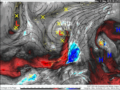 |
500 mb flow aloft and atmospheric water vapor.
The divergent flow aloft and increasing shear provide the lift, shear and dynamics for potential severe storms. |
Other necessary ingredients include CAPE (Convectively Available Potential Energy) which provides the energy for storms. This energy comes in the form higher moisture in the air and sunshine during the day.
CAPE values approach 1,500 j/kg or greater this afternoon
Severe threat will include damaging winds, small hail, dangerous lightning and a potential tornado. Be alert and aware!
 |
| Greatest Severe Threat After 3 PM |
 |
| Hour By Hour potential storms at 5:30 PM |
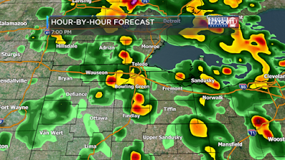 |
| Hour By Hour potential storms at 7 PM this evening |
Stay with the WTOL StormTrack Weather team for details and coverage this afternoon and evening!
~Meteorologist Chris Vickers


